Monday, June 30, 2014

Day 18: Rest Day in St. Joseph, Missouri

And, boy, did I need it.

My legs were so tired from want amounted to back-to-back century rides with 200 miles ridden over the past two days.

Besides sleeping in (which meant sleeping until 6 a.m. instead of heading downstairs for breakfast at that time), my morning consisted of breakfast, washing and lubing my bike, washing my clothes and getting a massage.

We made a quick trip to the local bike shop, Horizon Cycling, but it was a wasted effort.  They were fresh out of the types of pedals I use so I'll continue to use the borrowed pair Gene gave me back in White City for the duration of the ride into Indianapolis.  Shouldn't be a problem.

The early portion of the afternoon was spent sightseeing.  A bunch of us hitched a ride into town from a former America By Bicycle staffer and rider who now resides in St. Joe's.  He can come to the hotel last night to offer his services.  As he lives on the bike route, many years ago, he used to host one of the SAG stops right at his home.  He now spends more time away from St. Joe's so no more SAG hostings.

St. Joe's had its heyday in the early to mid-1800's.  It was the western terminus for eastern railroads.  The town was the last stop for supplies for those traveling to the west -- whether they were panhandlers searching for gold, Mormons fleeing religious persecution, or the Army heading for their western outposts. 


Although it's hard to see on this map, the route we rode from San Francisco to Salt Lake City was the same route as the Pony Express.  From Salt Lake City to St. Joseph, the Pony Express used the more northerly Mormon Trail/Oregon-California Trail.  We, instead, rode the Santa Fe Trail into St. Joseph, a more southerly route.
Today, it is a shadow of it's former self.  Much of the museum/waterfront district that we saw today was rundown and well past its prime.  Even the historical district is falling apart.  While there have been attempts to revitalize the waterfront area near the museums, nothing had taken and the area continues to slowly decay.  

What we saw yesterday as we rode into town was in stark contrast to today.  Yesterday, we passed homes that looked like their would fit right in around Montclair.  Some developments could easily have been anywhere in the New York metro area.  Such a difference between one end of the city and the other.
The site of his actual house was farther up the hill.  While wanted by the Federal government, Jesse James remained a local hero in these parts.
We toured the Pony Express Museum as well as the house where Jesse James met his demise.  We were also going to see the Patee House Museum but the power went down in that part of town, so we could only see it from the outside.


A Moment In Time:  at 7:15 p.m. on April 3, 1860, The Pony Express begins.  Riders will carry the news of Presidential elections, the firing on Ft. Sumter and the start of the Civil War to citizens in California.  Total time for mail to get to the West Coast:  10 days.  Prior to that by boat:  2-3 months.
The Pony Express Museum was actually worth the visit.  I had no idea that, for all it's legends and notoriety, the actual operations were but a moment in time.  The entire endeavor lasted a mere 19 months, by which time telegraph lines from the same St. Joseph to Sacramento route were completed and shut down the relay mail service.


The Patee House was the state-of-the-art hotel of its time, and that meant ANYWHERE in the United States.  All the rooms had individual baths and many had showers, unheard of at that time.  Trivia bit:  Walter Cronkite's father has a dental practice in this building years after the hotel was closed down and it was renovated into offices.
The rest of the afternoon was spent with the Dutch watching the thrilling Germany-Algeria World Cup match.  What started as four of us sitting in the lobby watching the game on their big screen TV soon turned into a festival of 20-30 people all cheering, drinking, laughing and enjoying the exciting match.  Total strangers all, yet all brought together for an hour of great fun.

Tomorrow, we're back in the saddle and off to Chillicothe, Missouri -- the home of the original bread slicing machine (I've been cautioned not to refer to that town as "the home of sliced bread").  90 more miles of rolling hills.

Sunday, June 29, 2014

Day 17: Topeka, Kansas to St. Joseph, Missouri 89 miles. 2850 feet of climbing (although it felt like a whole lot more!)

Not sure when I'll be back.  Not sure why I'd be back. 
Today was a good day.  A long day.  A very humid day.  But a good day.

We got some unexpected news this morning that changed our normal "get out of town" routine.  I should mention here that among our morning traditions, over breakfast we tend to listen to the Weather Channel.  It's always thrilling in the Plains States to see stories about tornados and hail storms and hear about thunderstorm forecasts while eating bowls of oatmeal and fruit.

The cresting waters of the Missouri River, taken from the Atchison, Kansas side.  Atchison was famous for its railroad (Atcheson, Topeka and Santa Fe line), the home of Amelia Earhart, and a landing site on the Lewis & Clark's expeditionary trail.
Anyway, back to this morning's news.  If any of you have been watching the Weather Channel yourselves, or have been privy to the recent weather patterns across the midwest, you'll know it's rained a helluva lot.  So much so that both the Mississippi and Missouri rivers are reaching cresting levels.  At 3:00 a.m. this morning, the weather service issued a warning about the Missouri River cresting any time after noon today in Atchison, the town we were riding through to cross the Missouri River into Missouri.  The local police were warning travelers that, in all likelihood, they would be closing the bridge across the river to all traffic once it reached 22.4 feet in height.  At 7:00 a.m. when we left the hotel for our ride out, the river was nearing 22 feet in height.  So this morning's ride became a bit of a race against time.  As such, I didn't stop to take pictures until I got to the other side of the river.
The next three days are some of the most challenging rollers on this entire trip.
We all rode hell bend for leather (love that expression and so appropriate here in cowboy country!) to reach Atchison, 57 miles away.  Happily, we all made it before 11 a.m.  The route in the morning also was accommodating.  Yes, we had rolling hills, but they seemed to be more gentle slopes, both up and down, than those we'd hit in the afternoon.  
Today's elevations.  That giant trough just before mile 60 is the Missouri River basin.  Think of it as a cross-section of what the land looks like around a big river.
I mentioned that it was quite humid today.  I found out later that it was a constant 90% humidity and it always looked as though a rain shower could break out at any time.  Fortunately, that didn't happen.  But my bike jersey was soaked through from the humidity and sweat; just as wet as my jersey was yesterday in the rain.  It was a choking kind of humidity all day. 
The elevation map is one way to show the ribbon of undulating roadway we faced today.  Here's a better example of the up/down/up/down kind of riding we are dealing with throughout the Missouri River Valley.  And notice, no shoulders.  We share the road with all manners of vehicles on this trip.
 A weird thing happened to me towards the last 15 miles of the ride.  I had followed the four Dutch riders plus Chuck, one of the fastest riders in the group, on the way out of the last SAG stop in the tiny town of DeKalb.  I'm not sure where I got the extra energy from, but after being passed on the flats by Franz, the fastest of the four Dutch riders, I decided to try and catch up to him.  By then, Franz was at least a quarter of a mile ahead of me and riding at a very fast pace.  Somehow, I got my speed up to 25 miles per hour and nearly caught him.  But, as I got close to Franz, I had exhausted my reserves and eased back into a more comfortable pace for myself, resigned to the fact that I could never keep up with such a faster pace.  At the point, Chuck, who had been behind me and watching my acceleration, passed me and joined Franz for the ride into St. Joseph.  The other three Dutch riders quickly passed me as well.  Figuring they'd be so far in front of me, I remained at my comfortable pace, content to just finish the ride alone. 

Coming over one of the final hills before entering St. Joseph, I was surprised to see all five riders stopped at a stop sign.  Although I was still far away from them, I could tell they weren't moving to cross the road.  Instead, all four Dutch riders were on their smartphones checking to see the results of the Netherlands/Mexico World Cup match (Holland won, 2-1).   I soon caught up with them and we all wound up riding the remaining nine miles into the hotel together.  About four miles later, thinking we had missed a turn, we stopped an oncoming rider to ask for directions.  She dismounted her bike, asked us about who we were and where we were heading and talked bike talk with the guys from Holland.  Before she left, she welcomed us to her fair city of St. Joseph, "Where the Pony Express started, and where Jesse James' life ended."
A perfect end to a good day of riding.  One thing about riding with the Dutch -- they love their beer at the end of a day's ride.  Today, we celebrated Chuck's birthday and the Netherlands World Cup win over Mexico.
Tomorrow, as we have a much needed day off, I'll try and further explore some of those stories, as well as do some laundry and wash down my bike.  


Saturday, June 28, 2014

Day 16: Abilene to Topeka, Kansas 111 miles. somewhere between 3800 and 4500 feet of climbing (dualing Garmins)

I'm spent.  All I actually want to do right now is crawl into bed.  We've just finished dinner and this is the time everyone goes back to their respective rooms and writes their blogs.  If you saw most of the riders tonight at dinner, you would have witnessed such a quiet crowd, barely getting their forks to their mouths.  None of the typical banter between fast-growing friends.  Today was a long, tough day for most of us.  Even the fast riders felt it today.

[I'll apologize ahead of time for the lack of pictures from parts of today's ride.  My phone conked out in the morning and I didn't get it working again until after some great shots.  I also chose not to take pictures during the various bits of downpours.  I missed some great shots of the brilliant blue skies once the morning rains cleared.  I also missed some wonderful examples of barn art -- hopefully, there will still be opportunities tomorrow -- that reminded me a lot of Amish hex signs on barns in Pennsylvania.]

Today we travelled due East through a very undulating Kansas countryside.  Kansas may not have any mountains, but we're in the Flint Hills and there are plenty of short, steep hills (very similar to Connecticut -- no mountains but bitch'n hills) to wear you down.  We didn't get an elevation map of today's ride, although the one I've seen for tomorrow will more than adequately provide insights into how many hills we climbed today as tomorrow is more of the same.  Some people call these types of hills "rollers" and we were constantly going up and down and up and down.  These hills weren't close enough to enjoy the momentum of the downhill ride to carry us up and over the next hill.  They were spread far enough apart that each climb (in the morning they were merely 3% or 4% climbs but, as the day advanced, they got steeper into the 6% and 7% range) became a new challenge unto itself.

Coming out of breakfast this morning, I was reminded of something I left out of yesterday's blog.  About four miles before entering Abilene, we passed by the National Greyhound Association and all their facilities.  Abilene is, apparently, the Greyhound capital of America.  This morning, many owners were taking their dogs out for their morning constitutionals, in the rain (more on that in a moment).  This weekend was their big convention in Abilene and the hotel was packed with cyclists and dog owners.  The dogs were beautiful and quite friendly.

I also failed to mention the serious repair job Mark, our mechanic, did on my bike last night.  Something in my rear cog shifting got stuck and I wasn't able to shift properly into smaller gears, especially needed for hill climbing.  It took Mark the better part of 80 minutes to find the problem and fix it.  Thank goodness, as today I was in real need of those gearing.

Okay, back to this morning.  We left the hotel in the rain.  The forecast wasn't looking good with at least a 50% chance of thunderstorms all along our ride route.  But, half an hour after leaving Abilene, the clouds began to clear, the rains stopped and the most gorgeous blue skies caught everyone's attention.  Again, sadly, no pictures.  

The rest of the morning ride up to our first SAG stop was a series of sun-swept rolling hills all along horse and cattle farms.  We all noticed how green Kansas was.  It seemed so unusual compared to the past week in Colorado.


Downtown White City.  They were having a town-wide tag sale.  Also notice the brick street.  Almost a lost art.
Sometime in between our departure and our first SAG stop (about 20 miles into the ride), my left pedal broke.  I was able to patch it together to get to the SAG stop at the 35-mile marker.  There Gene, one of our ride leaders, swapped out my pedals for a used pair that were in the van.  They held together for the duration of the ride.  Unfortunately, the bike shops in Topeka were closed and it's likely the one bike shop in St. Joseph, Missouri won't be open tomorrow either so it looks like I'm going to be riding on those pedals until sometime next week.


Downtown Eskeridge.  Okay, so every quaint, local cafe isn't a five-star affair.  I guess I got lucky yesterday.
About ten miles out of our second SAG stop, in Eskeridge, the heavens opened up again.  There had been on and off sprinkles in between, but nothing to worry about.  This second downpour, however, had all the makings of trouble.  I was in no man's land.  Too far to turn back to Eskeridge and ten miles until I got to the nearest thing to a town, Dover.  So I kicked it in an extra gear and hauled ass for Dover.  Soaking wet, I got to the one store in town, famous for their pies, and ducked under the protection of their front porch.  There, with Gene, I waited out the lightning and thunder until it was safe to ride again.  All told, along with a slice of pie and a large cup of hot tea, that was another half an hour off the bike.  (You might need to turn up your sound on the video.  You'll hear how tired I sounded after 90 miles!)


The remainder of the ride was another series of rolling hills through a little drizzle.  I got to the hotel after over eight hours of riding, soaking wet and bone tired.  I'm going to bed early tonight.  Tomorrow is an 89-mile day into St. Joseph, Missouri followed by a much needed rest day.

Friday, June 27, 2014

Day 15: McPherson to Abilene, Kansas 65 miles. Flat as a Pancake (last day on the plains)

Yesterday was the day to scare the living daylights out of me.  Today was the day to enjoy the peace and tranquility of the back country roads of Kansas.  Total opposites.

This was the view for most of the day: riding through corn and wheat fields.  So picturesque.  So peaceful.
We travelled in a northeasterly direction for much of the day in military fashion:  left, right, left, right.  There are no diagonal roads in rural Kansas.  The surveyors did an excellent job of plotting out the roadways in a predictable, grid-like manner.  Left turns meant the winds were at our backs.  Oh, those were so nice!  Right turns meant we were either dead into the winds or had strong quartering winds to content with.  

A true one-room schoolhouse set between farmland and a grain silo.  And maybe five homes for miles in either direction to support this tiny school.
With the exception of the first nine miles along US 56, most of the day was spent riding along county roads and passing through sleepy little towns.  Okay, that's a bit too romantic.  Some of the towns were downright moribund.  But it was still a peaceful and relaxing day, even with the same, persistent southeasterly winds and another flat tire.

This is "downtown Gypsum."  Just before arriving here, we passed through the town of Roxbury.  None of the seven buildings that made up the one intersection in Roxbury were still in business.  Even the furniture or other items in the windows of the buildings were old and decrepit.  Gypsum was, maybe, two blocks long and had more houses, but it still had the same "we died but no one told us" feel to it.
We passed through the towns of Galva, Canton, Roxbury, Gypsum and Solomon before entering Abilene, the hometown and final resting place of President Eisenhower.  While the farmlands were a portrait of nature's beauty, the towns were another matter altogether.  Until we rode through Solomon, the first four towns were either case studies for how small town farming is dying or how the recession has been particularly hard on the farm belt.  It was such a sad juxtaposition to see the death of small towns right after passing through living fields of grains.

Oddly enough, at our one rest stop in a small park in Gypsum, a woman came up to us and started asking us questions about our ride, including how many riders there were, whether or not we were riding for charities, etc.  Turns out, she has been coming here every year for at least 18 of the 20 years this ride has been organized.  And, every year, there's an article in the small town/regional newspaper about us.  She was so diligent on getting names and spellings correctly and queried us on aspirations not just destinations.  
Must be the impending site of a Jewish Community Center!
I was last in the heartland of Kansas in the early 80's.  At that time, there were people looking at the back of my head to see if I had horns.  True story!  So seeing a Star of David on the side of a barn while I was riding through Kansas wheat fields who totally unexpected.  I can't tell you why that was there, but I thought it surely deserved a photo as proof I wasn't hallucinating.

As we were riding through the farmlands, right in the middle of nowhere, out among the corn and wheat fields, stood one of our sag (Support And Gear) vans parked by the side of the road.  And there, in front of it and marked in bright white spray paint, was a sign marking the midpoint between our San Francisco start and our Portsmouth, New Hamsphire finish.  We had travelled halfway across the country (okay, some of us took more than one year to get here!).  Still, it felt really good to have reached this milestone.
The Actual Halfway Point between San Francisco and Portsmouth.  Even the Kansan surveyors weren't THAT precise!
Riding through the town of Solomon, I could see signs of life.  This was still rural countryside, but there were more houses, even though the only "downtown" we could see was a single church and a convenience store.  No curbs.  No sidewalks.  

Eight miles past Solomon, we finally reached Abilene.  Much smaller than it's Texas namesake, Abilene, Kansas is a true example of small-town America.  With a population of just under 7,000, it's got a well-developed downtown as well as its star attraction, the Eishenhower Museum and Presidential Library.  As we approached downtown, we rode through a couple of lovely neighborhoods with rows of wonderfully preserved Victorian homes.

Stuck in the middle of railroad crossings and a very depressed neighborhood of run down houses on the outskirts of Abilene, here sits this beauty of a Victorian mansion, the Lebold House.
At the suggestion of Michelle, one of our ride leaders, a number of us stopped for lunch at a small cafe just off of the main intersection, called "The Dish."  The food was really special and you could not complain about the prices.  A bowl of Asian Chicken Vegetable soup, a pulled pork quesadilla and two large iced teas for ten bucks.  Sweet deal.

I try as often as possible to sample the local fare and to help support the local economies.  It doesn't hurt at all when the food is a good as it was here.
Just before heading to the hotel, I felt a pang of guilt, so I turned my bike around and rode down the road for half a mile to see the Eisenhower Presidential Library and Museum.  It's also the location of his ancestral home as well as the chapel where he's buried.  Apart from some very worthy historical information (as well as his papers, etc.), it was much less than I was expecting.  And, in this digital age, it still relied way to heavily on the printed word, which made it a very tedious exhibition.  

The Eisenhower Presidential Library (just out of the picture to the right) and Ancestral Home (left) and Museum (behind me).  Great for fans of American history from the 40's and 50's.  Average for everyone else.
Tomorrow, we're on to Topeka.  109 miles, probably into those same southeasterly winds and the threat of more thunderstorms both in the morning soon after departure and at noon in Topeka.  Could be a pretty hairy day.  Also, we'll be getting back into elevations and climbing tomorrow.  No more rest for the thighs.


Thursday, June 26, 2014

Day 14: Great Bend to McPherson, Kansas 67 miles. Flat as a Pancake

Cold.  Wet.  Windy.  Scary.  

That about says it all for today's ride.  

We started on the road a bit later as a big thunderstorm had rolled through Great Bend around 6 this morning.  The forecast for today had been for sun in the morning and a noontime thunderstorm at our arrival city, followed by sun in the afternoon.  What we experienced was nothing like that.

We left our hotel about 7:45 this morning and, immediately, we could see another storm front barreling in from the west.  So the ride out of Great Bend became a bit of a race against the rain.

For many of us, that lasted only about seven miles.  The farther we got away from Great Bend, the darker the skies got.  With the first drops of rain, we figured that this would be a wet day.  Little did we know it would get far worse.  Almost on cue at the seven mile mark, lightning started flashing all around us.  Immediately, the two support vans pulled up and picked up most of the riders.  Some riders ignored the call to stop riding and kept going onto the next town, Ellinwood, where they found cover.  The rest of us dropped our bikes by the side of the road and climbed into one of the two vans.  From there, we watched the light show of lightning bolts all around us.  That lasted about half an hour.  Oddly enough, the storm front came from the west, but the winds were coming strongly from the south.  None of us could figure that out.

The one picture I took all day.  The first storm had passed through and, approaching Ellinwood, it was just a light drizzle.  The wheat shocks caught my eye, hence the photo.
According to the radar, the heavy storm cell was moving swiftly west to east, so after a time, it was deemed safe enough for us to return to the road.  We were cautioned, however, that if we saw more lightning or felt uncomfortable riding on the road, we were to find safe shelter.  That could be a barn, someone's home (with permission!), or any other place for protection.

Early on, the ride after our break was actually pretty comfortable.  We rode through a light rain into the town of Ellinwood.  The temperature was in the high 60's and, yes, I was soaking wet, but my body felt warm from the constant motion.  All that, however, quickly changed.

Remember, we were riding through the Kansas countryside.  Basically flat with an occasional roller (a rise of about 50-100 feet followed by a similar descent).  We were riding through farmlands with the odd grain elevator or barn.  No major structures.  No major cities.  Not a lot of places to gain shelter.  

And that's about the time that the storms reappeared.  The storm cells that were supposed to head east had reformed from the south and lightning was firing all around me.  I was about ten minutes behind most of the group, but when I saw two lightning bolts strike ahead of me on both my left and right, I knew it was time to find cover.  The nearest shelter was a barn about half a mile down the road.  As I rode to the small lane that included a house and that barn, I saw no cars in the house driveway, so I just proceeded directly to the barn.  It was a huge, open structure that housed two large combines and other smaller assorted tractors.  The winds were whipping up in their intensity, but I found a spot tucked right up against one of the combines that provided protection from the wind.  I was soaked and cold.  But out of the way of the lightning.

About half an hour later, the skies looked a bit clearer, so I ventured out from the barn.  It was still raining, albeit lighter now.  The skies looked a bit lighter as well, so I guessed it was okay to proceed.  Wrong!  Four miles down the road, the lightning was back.  So I found a new shelter in the form of an abandoned building with a large porch.  There I waited for another half an hour.

I would repeat this twice more before the skies truly relaxed and cleared any further electrical discharges.  The rest of the ride into McPherson was uneventful.  But this was the most exhausting and scariest ride I've ever ridden; not from the distance but rather from the constant looking up at the skies for more lightning.

Tomorrow the weather is supposed to be better.  We're heading to Abilene and the Eisenhower Presidential Libary/Museum.


Wednesday, June 25, 2014

Day 13: Dodge City to Great Bend, Kansas 86 miles. Flat as a Pancake

Today was a beautiful day.  Nice ride.  A very mild headwind.  Mostly smooth roads.  All in all, a good day.

I'm not sure what it was this morning, but I was somnambulant.  I forgot to sign out at gear loading this morning.  And I couldn't find the right groove leaving Dodge.  It was just one of those days where I tried to figure out if I was really up for riding this day.  For the first 25 miles or so, I just couldn't find the right rhythm.  

I kid you not.  Today we passed more tractor dealerships than car dealerships.  Yes, Virginia, this is farm country!
Then things changed and the rest of the day went like clockwork.  I think it was when I stopped to take a picture of a mural on the side of a taco shop in the tiny "town," if you could call it that, of Offerle.  Once I got back in the bike, everything changed for the better.

The past few days, we've ridden by a number of these murals.  This one actually was very well done.  They all recount the history of the area; some far better than others.
From a sightseeing point of view, there wasn't much to take in today.  Soon after we "got the heck outta Dodge," we were riding through a huge wind farm.  I missed the sign that listed all the stats, but was told at dinner tonight about how long each of those blades you saw in my photo yesterday was and how tall those towers were and what speeds they turn, etc.  I didn't stop to take a picture as you've already seen them from previous days' photos.  But it felt a bit surrealistic, as if I was in the middle of an animated scene from the Pink Floyd movie, "The Wall" with tiny me running through the middle of those giants (and no, it wasn't an acid flashback!).

Welcome to Kinsley, Kansas, the midway point between the oceans.  But not the midway point for this cross country cycling challenge.  There's an additional 500+ miles to get to Portsmouth, New Hampshire.
I can see for miles and miles and miles and miles and miles.  With kudos to The Who, we finally left US 50 and turned onto US 56.  Much narrower shoulders, but the road was smooth as silk.  So we take our choice:  narrower shoulders where we're closer to the trucks or wider, choppier shoulders that rattle our teeth, but are farther away from the traffic.  Most everyone today preferred the former.  Also, as you can see, this road was straight as an arrow for about 20 miles.  
From there, it was riding through a string of very small towns:  Wright, Spearville ("Home of the Wind Farm"), the aforementioned Offerle, Kinsley ("Midway USA"), Garfield, Larned, Dundee and, finally, Great Bend.  Adding to the litany of mass producers of foods and foodstuffs I've passed was the ADM plant outside of Dodge City.  I'm sure they were processing all the corn for high fructose corn syrup.

About two-thirds of the way into today's ride, US 56 ran through this small town of Larned.  It was quaint and depressing all in the same breath.  Many storefronts sat empty.  Nearly everything was old or in need of repair.  No new stores.  No real restaurants to speak of.  Mostly everything to accommodate the needs of the local farmers.  This downtown actually ran for three or four blocks as opposed to Cimarron, which we passed through yesterday and stopped at Clark's Drugs.  That was just big enough to afford an intersection.
I forgot to mention this in previous posts:  There is a smell about Kansas that would disavow any desire to drive a convertible through this state.  For the most part, I would assume it's the feed lots and farms that give off their noxious stenches.  But there are other foul smells that always catch us as we're riding through the countryside.  After a while, we kind of get used to them, but they remain an offensive experience.  

And yet, there were two occasions, that we later talked about and agreed upon over dinner, when we found ourselves smelling something quite out of the ordinary and unexplainable.  The first was when we all came over a rise just before entering the town of Hasty.  We all sensed something that smelled like pipe tobacco.  The second was just before coming into Dodge City.  There, the smell reminded many of us of freshly baked bread.  Not one of us could find a logical explanation for either experience, but we all agreed that those were far better than the typical smells of manure.

Tomorrow, an easy ride East into McPherson, Kansas.  Then we start turning to the Northeast and head towards Abilene, Topeka and St. Joe's.


Tuesday, June 24, 2014

Day 12: Garden City to Dodge City, Kansas 53 miles. Flat as a Pancake.

Me and the Boys want to welcome y'all to Dodge City
It was a funny kind of day today.  Not a long ride.  Lots of stopping to take pictures.  A light drizzle halfway through the ride.

It was a funny day from the very start.  Because it was so short a day, we were allowed to sleep in.  Breakfast was whenever we wanted to eat, but load wasn't scheduled until 8 a.m. with the ride starting right afterwards.  That threw many of us off our usual routine.  I kind of get programmed after a while and even a rest day doesn't affect me because I'll go right back to the same routine.  Wake up at 4:30 or 5:30.  Breakfast at 5:30 or 6:00.  Load at 6:00 or 6:30 and off onto the road.  Not today.

It was also different today because this was Peter's last morning with us.  Peter, our resident aeronautical engineer, pilot and professor, was heading back to Massachusetts to his teaching job.  Having ridden with Peter last year, this goodbye was a sad reminder of how he had to leave to take care of his ailing father.  Peter's a good egg.  Encyclopedic mind and happy to share his knowledge with you.  Dinner with Peter usually became either a history or aeronautics or meteorologic lesson.  And no one complained.  Safe riding Peter.


Wind turbine blades at their manufacturing site, just waiting to be installed.
And, a bit farther down the road, those blades being put to good use.
Once we got out of Garden City, it was a basic straight shot down Route 50 in a southeasterly direction to Dodge City.  As we passed the Tyson Chicken plant yesterday, it was only fair to pass the Conagra Beef Processing facility today.


Your future burgers hard at work.
The highlight of the morning was our collective stopping in Cimarron at Clark's Pharmacy, an old-fashioned drug store/ice cream parlor with soda fountain service.  Even though it was only 10 a.m., we all stopped for either sundaes or smoothies.  They were soooo good!  Great folks running the place.  Apparently, this stop has become an America By Bike tradition, so they were expecting us.
America's highway system in the mid-1800's.

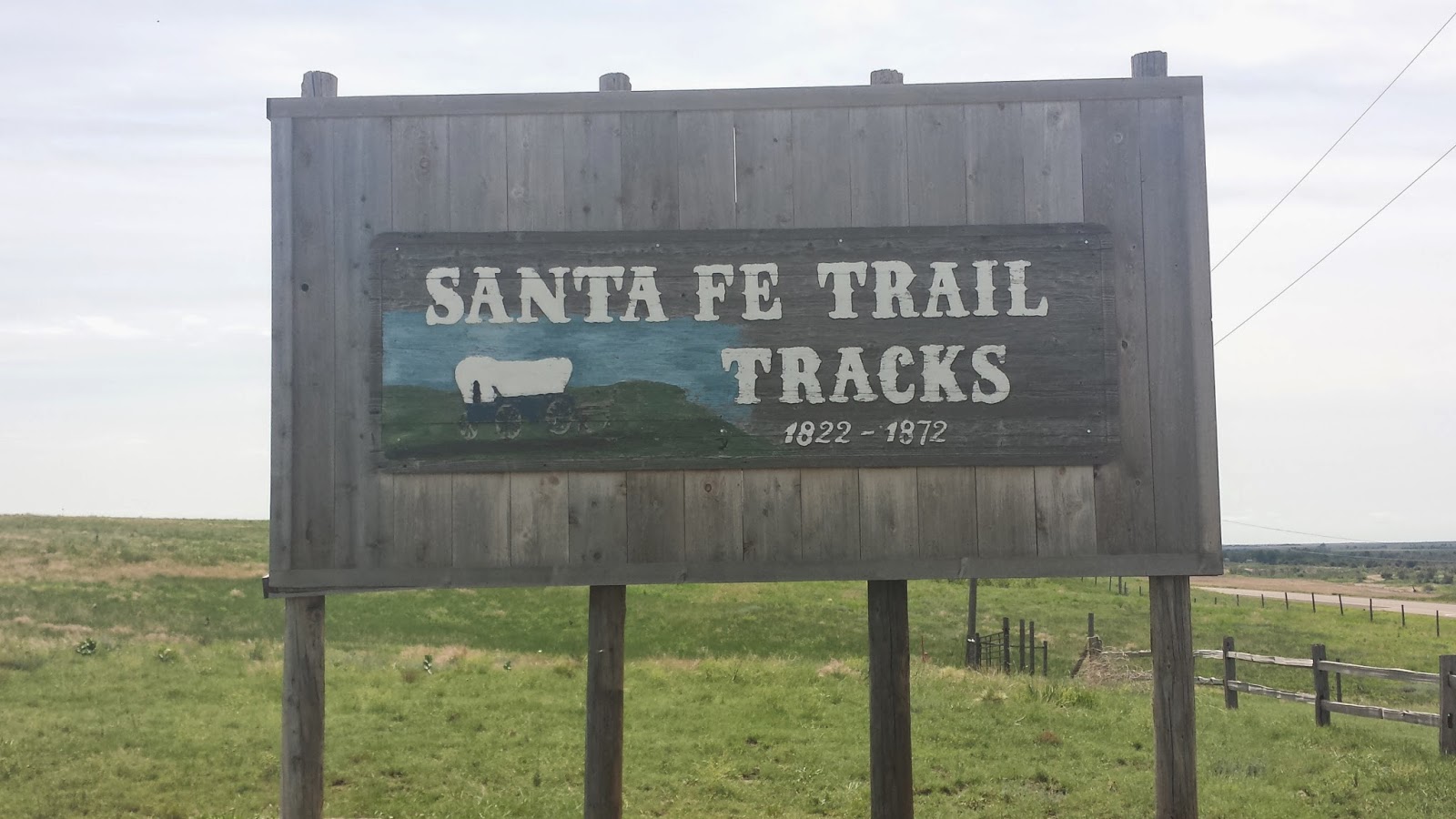
More sightseeing along the way with the Sante Fe trail.  Two things I learned:  The Arkansas River was, at one time, the border between the United States and Mexico (I didn't know the Kansas territory was our southern border there); the Santa Fe trail was basically the US's east-west highway for covered wagon trains before the railroads were built.


If the showbiz actor who comes out and talks to you in an "authentic" western drawl isn't cheesy enough, the height of the tackiness of this place is what's anchoring the line of "historic" western stores at the other end from the museum…an Applebee's!  Truly disappointing.  But maybe not as disappointing as riding past Doc Holliday Liquors!
Arriving into Dodge City and riding down Wyatt Earp Boulevard, I was all excited by all the billboards announcing Boot Hill and the Museums and the historic downtown, etc.  What a disappointment when I got there.  The "historic downtown" is just a strip of stores made up to look like what they would have 150 years ago.  Disney does better.  The Boot Hill Museum is nothing more than a tourist stop.  And Boot Hill is now on the corner of Front Street and 5th Avenue.  Fortunately, I found a really nice local place, Cup of Jo-nes, for lunch.  Friendly staff, good food and excellent smoothies.

Tomorrow, we're back on our regular schedule and heading to Great Bend.